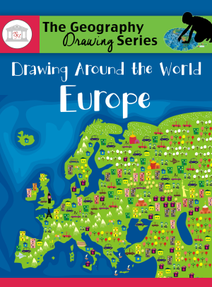
The Kimberly Garcia's Geography Drawing Series consists of two worktexts that teach students how to draw states and countries accurately from memory. Students primarily learn how to draw the outlines of countries or states and how they lie in relation to neighboring countries or states. You will use other resources to have children fill in tables with basic data on each country or state as well. This is not comprehensive geography, but it should help students grasp geographical relationships, and they’ll learn, for example, that Norway, Sweden, and Finland are part of Europe.
Drawing Around the World: Europe and Drawing Around the World: USA are two books in the series, although more might be added in the future. Both books follow the same format whether students are drawing entire countries (for Europe) or individual states (for USA).
These are substantial books with about 240 pages each. However, the strategy used for the lessons requires students to frequently draw on pages that are identical to others used throughout the book. The value of having these pages all printed in a book is that it easily reminds students what to do next since at the top of each such page, it says, “Day 1” (or Day 2 or Day 3). The publisher gives homeschoolers permission to copy pages in each book for their immediate families. They also sell a downloadable PDF version. Since the bindings on the books do not allow the books to easily lie flat and most student activities require drawing, I suspect that most parents will either photocopy pages or print from the PDF version rather than have students try to work in the book.
Comprehensive maps at the front of each book can be used for reference. After that, the types of pages repeat for each week. Although lessons are repetitive, they build upon one another. I will use the Europe book as my example for weekly lesson plans. (Think of states rather than countries for the layout of the USA book.)
On the first day of each week, students complete about three pages that each have an outline of one country. They trace the outline then draw it on their own in a box right next to it. Below this is a table for “Country Facts”: area/population, capital, people (cultures), major religion(s), climate, and resources. Still on Day 1, students trace and label the countries they have just drawn on a dotted line map of Europe. They conclude the first day’s lesson by drawing and labeling the new countries on a grid map that shows only the edges of neighboring continents. This forces students to pay attention to the longitude and latitude lines on the dotted-line map.
On both Day 2 and Day 3, students trace and label all of the countries they have learned from this week and previous weeks onto the dotted-line map. Then they draw all of these countries onto the grid map. They will repeat this same exercise both days on separate pages for each day. Students should use colored pencils for drawing and possibly coloring in the countries.
On Day 4, students have a page with lines on which they are to write from memory the names of all countries learned thus far. (The number of blank lines gives them a clue.) They conclude the week by drawing and labeling all countries learned thus far in a large blank rectangle—no grids or other clues.
You can see how the lessons become progressively more difficult in the amount of drawing and labeling required. However, students will have drawn some countries over and over again for many weeks, and those should become very easy for them.
The concept of Drawing Around the World is very simple, relying on repeated drawing to reinforce learning.
The Country Facts are probably only somewhat useful. Students should try to learn the capitals of countries and especially the capitals of each of the states in our own country, However, Country Facts or State Facts are not likely to be memorable without some other sort of learning or reinforcement. Ideally, you would use this alongside a course for studying European countries and cultures (in the case of Europe) or U.S. History (in the case of the USA book). The books each list two websites that might be used as sources for the facts, and they each also recommend a useful source book: The National Geographic Bee Ultimate Fact Book: Countries from A to Z for Europe and The National Geographic Kids United States Atlas for USA respectively.
Drawing Around the World is simpler to use for both parents and students than some of the other options that try to help children become familiar with the basic geography of countries and states. It is excellent for teaching students to accurately draw them even if it leaves a broader study of geography for other resources to cover.


