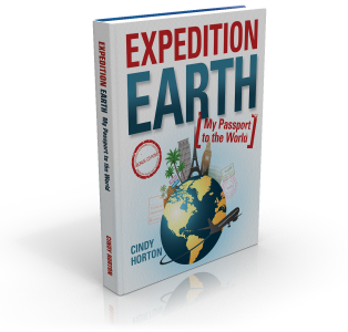
Expedition Earth is an ebook geography course for students in grades five through twelve. The ebook has a number of components with many suggested activities. You can choose how many of the activities to use, keeping in mind that spending about 60 hours working through course material and activities will provide a half credit for high school students. For a full credit, students need to spend about 120 hours.
The core of the course is the 223-page textbook. It has 195 country pages covering almost every country in the world. It is divided into units by continent, with countries within each continent presented in alphabetical order, one page per country. Each page has a light background map of the continent showing where the country is located. A large, outlined shape of the country showing its capital is more prominent since students will learn to recognize countries by shape in one of the flashcard games. Country flags are likewise prominently featured so that students can learn to recognize them for a game. A brief list of facts appears in a box listing the full name of the country, population, currency, land area, major religions, highest and lowest geographical points, and the number of regions into which it is divided.
“Did you know…?” lists a number of interesting facts about the country. This is generally followed by one or two short topical articles. For example, for the country of Libya, there is a short paragraph about the Libyan Desert and two paragraphs about the town of Ghadames.
The 114-page book of lesson plans explains what students should do each day. The lesson plans are what make the course interesting. Students will read the page from the text, but they will also complete one or more activities from the lesson plan each day. Lesson plans highlight key words that students should research. Key words include the names of the countries but there often other key words such as “Berbers” in the lesson on Libya, “dodo bird” for Mauritius, and “Atlas Mountains” and “Western Sahara” for Morocco. These “secondary” key words have weblinks following them for students to read more on that topic or watch a video. Students are on their own to locate more general articles or information about each country, but author Cindy Horton recommends gathering library books to have on hand for source information or special topics as you study each country.
Lessons are laid out for five days each week with a quiz at the end of each week. The quiz covers only the material provided in the Expedition Earth text. A lengthier quiz follows the completion of each unit of lessons on a continent. Answer keys are included as separate files.
At the end of the text are 12 recipes that can be used in conjunction with lessons on particular countries. A set of outline maps is at the end of the lesson plan book. Separate files with full-color time-zone and world maps are included.
I consider all of the components I’ve described thus far as essential to the course. There are a few additional components that I consider optional.
A book of flashcards has instructions for printing and using them. You will definitely want to print the flag flashcards in color, but if you’re trying to save money you might get by with printing the country shape cards in black and white. Consider whether or not you will actually use the flashcards before spending the time and effort on this.
There is also a set of templates for students to create their own passport and then use it as a mini-journal to record highlights of what they have learned. However, I personally can’t envision most high school students taking the time to do this without more specific assignments.
The ebook files include a printable cover page that can be used as a binder cover insert. It is up to you whether or not to print out pages from the text and lesson plans to go into the binder. I think the text pages will be useful for reference as students study for the quizzes, but you might find that you only need to print out maps and quizzes on which students will actually write. Many activities in the lesson plans direct students to “learn more” about particular topics, and parents might want to require students to write brief summaries of what they have learned from their reading and research. Those summaries could also be collected in the binder.
Lesson plans direct students to color in countries on the outline maps, but I think it would be appropriate for students to also do some labeling on their maps. You might even want to use larger maps such as those in Map Trek so that students can become more familiar with individual countries.
Expedition Earth offers an interesting approach to geography. If students do a minimal amount of work, reading the text and taking quizzes, they will still acquire some familiarity with the countries of the world. The deeper learning that can take place through research on topics in the lesson plans needs some sort of documentation that requires students to focus on appropriate information, assimilate it, and summarize it in writing to make it stick. So, the value of the course will depend greatly upon the way that parents and students choose to use it.


