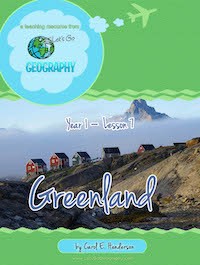
Let’s Go Geography is a subscription website that offers lifetime access to geography coursework in the form of downloadable files. The courses can be used with students in kindergarten through fifth grade.
The courses cover a total of 82 countries from all continents over the three years of the curriculum. The material is presented in weekly lessons since there is too much content to download a complete course all at once. You will access all lessons through your account. Those with students in grades three through five will need to also purchase the downloadable Discovery Pack of about 100 pages for whichever course they are using. Discovery Packs have decorated notebooking pages and materials for creating a geography glossary.
You will need to print a number of activity pages. Year 1 includes several activity pages in its review lessons that you may prefer to print in color. Outside of that, a typical lesson needs minimal color printing. Older students will need to print two Discovery Pack pages per lesson, as well as 11 Geography Glossary pages per year. Permission is given to reproduce pages for your homeschool.
You will want to work with the lesson file online since you will be accessing many resources—YouTube videos, maps, songs, information for students to read, and more. You can try a free lesson on Alaska to see for yourself how it works.
There are 32 lessons per course that are to be used one per week. Some lessons review previously learned material.
Children will create a Travel Journal for all of their coursework using a three-ring binder. Colorful Travel Journal cover pages are provided for free along with instructions and images for creating your own divider pages for sections for each continent or group of continents.
Lessons bounce around the globe in both courses, although every Let’s Go Geography year covers somewhere on each of the largest five continents. Australia and New Zealand are covered in the first two years, while Antarctica is covered in Year 3.
For example, in Year 1 the first lesson explores the northeast region of the United States. From there, lessons for the first third of the course progress through Hawaii, Canada, Haiti, Nicaragua, Belize, Greenland, and Chile—covering selected states, countries, or regions from North and South America. The second third of the year is spent on countries of Europe and Africa, while the final third explores countries from Asia and Oceania.
Each lesson features a variety of activities, videos to watch, and books to read that are suitable for the different ages within the range of kindergarten through fifth grade. In addition, you can choose among activities those that best meet the learning style needs of your children. You should not try to complete all activities.
For example, for the first week, students can color in the United States on a map; answer questions based on the map; color in the northeastern states on a more-detailed map of the U.S.; add labels to this second map and answer questions about the map; color, cut, and paste an image of the U.S. flag onto a printable activity page; listen to the Star-Spangled Banner; explore different regions through video links and reading material on linked websites; color the coloring page included in the lesson plan; and/or make a lighthouse craft. Some brief information is included within the lesson, but most information will be gleaned from web sources or library books. Older students will use the Discovery Pack notebooking pages to write about what they’ve learned. Those pages, along with map work and other activity pages, go into the student’s Travel Journal. Some color images of sites from the region are included within the lesson, and these, too, can be printed and added to the binder. Most lessons follow a similar format, summarized in each lesson’s “itinerary” as map, flag, music, explore, and color or craft.
As the lessons progress, students learn a few basic geographic vocabulary terms such as latitude, longitude, and Equator. However, since the courses are introductory, the emphasis is upon exposure to information rather than memorization and mastery. Through the videos in particular, children learn what the countries and their people are actually like. While they are exposed to some factual information, they are most likely to retain the cultural connections and memories of some geographical features and famous sites.
Geography of the World (a DK book) is recommended as a supplemental reference book for these courses, but it's not required. You can also borrow library books to read for each week’s lesson, but that, too, is optional. Lessons list the library call numbers for the section where you will find books on the region being studied each week, but there are no specific recommended titles nor are there activities to be completed based on the library books.
An optional, downloadable file for creating a Kid’s Passport is available as a "thank you" for liking or sharing Let's Go Geography on social media. It has pages for the different continents where students can paste images of each country’s flag as they study the country. You can use this one file over and over again.
Let’s Go Geography requires some effort on the part of parents or teachers to preview options and determine what is most suitable for their children. Gathering crafts supplies and library books also might take extra time. Nevertheless, having options makes it easier to tailor the course to your children and your circumstances. This is especially helpful for students in the elementary grades whose interests and abilities vary widely.


