Catholic Heritage Curricula has created geography courses for the primary grades: Explore the Continents for second grade and Tour a Country for third grade. Both courses use the Children’s Catholic Encyclopedia of Geography.
Both Explore the Continents and Tour a Country are purchased as three-hole-punched pages to insert into your own binders. Both are heavily illustrated in full color. The courses include hands-on activities, some of which can involve the whole family.
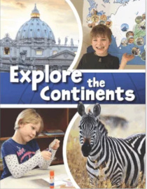
Explore the Continents
Explore the Continents uses the Children’s Catholic Encyclopedia of Geography and the set of 7 Continent Maps. You should also have a globe available for some lessons. The pages of Explore the Continents direct the use of the other resources. The introduction suggests spending five weeks per continent for six of the continents and three weeks on Antarctica.
The course is designed to teach research skills and the use of an encyclopedia as children learn world geography. Pages 6-13 of Explore the Continent teach children how to use dictionaries and encyclopedias, and the Children’s Catholic Encyclopedia of Geography in particular. Children then use the encyclopedia throughout the rest of the course to learn about geography, cultures, climate, landmarks, animals, and saints related to each continent.
The outline maps of the continents unfold to poster size. As they study each continent, students draw on its map, using reference maps in the encyclopedia. They also affix images cut from pages of Explore the Continents to create a colorful poster.
Sections of Explore the Continents are color-coded and include many pages that students cut apart. Among them are flashcard pages with pictures on one side and blank lines on the reverse for students to copy definitions from the encyclopedia’s glossary. Other images are cut out and affixed to the large poster map—images of landmarks, saints, animals, and people. Students read from the encyclopedia about many of the images as they cut and paste them.
Each section has a few pages with other learning activities. For instance, the other North America pages include one on habitats that asks children to identify the animal(s) that do not live there, and the same page directs them to read about beavers and write two sentences about them. On the page with images of people to be cut out are discussion questions, and another page has students create a salt dough map of North America. A few additional ideas are included, such as baking a cookie in the shape of the continent and taking a field trip to a zoo. A resources page at the end of the book lists recommended read-aloud titles for each continent, although these are optional. In addition, many virtual tours of landmarks can be accessed through either the QR code or URL in the introduction to the course.
Midway through the course and at the end are review pages with questions and fun activities. The culminating activity is an International Cuisine Night, where children help plan and prepare a meal based on an international theme with food, decorations, and costumes.
Tour a Country
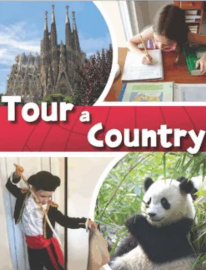 Tour a Country has students spend one month each studying the countries by referring to special sections of Children’s Catholic Encyclopedia of Geography on Canada, China, France, India, Italy, Peru, Spain, and the United Kingdom. Students also need the Folding World Map that has loads of information on both front and back.
Tour a Country begins with instructions, pages for creating a passport, suggested enrichment activities, and seven worksheets for learning research skills (alphabetizing and the use of maps, the encyclopedia, and the glossary). An answer key for the worksheets is at the back of the book. Though easy to overlook, the enrichment activities on page 4 can be used for all the countries.
Following the section on research skills are the country lessons. Color-coded pages for each country include detailed instructions, maps, a template for a travel brochure, several pages of images to cut out (the country’s flag, attractions, people, places, events, Catholic shrines, saints, native animals, and natural wonders), enrichment activities, and a suggested book list.
Spending one month per country, students create a travel brochure from the pages and cut-outs. They look up and write information from the Folding World Map. They conclude each study with an oral presentation of their brochure. They also draw on both the large map and on a smaller map included in the book.
In addition to reading the lengthy sections on each of the eight countries in the Children’s Catholic Encyclopedia of Geography, they read encyclopedia articles about the images they select.
Children’s Catholic Encyclopedia of Geography
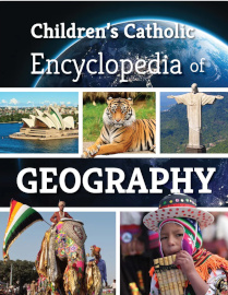 Children’s Catholic Encyclopedia of Geography is a 316-page, hardcover reference book for grades two through eight. It has 400 entries for topics from all over the world and some that are historical. Entries are relatively consistent, with about a half page of text and one image sized 1/25” x 3.25”. Entries are written at about a fourth and fifth-grade level but can be read aloud to younger children.
This book is intended specifically for use along with two CHC courses, Explore the Continents and Tour a Country. After a two-page explanation for children of how to use an encyclopedia, the book has two special sections with maps, photos, and text. The first section on continents is especially pertinent to Explore the Continents, and the second section focuses on the eight countries studied in Tour a Country. The bulk of the book consists of the A-to-Z encyclopedia entries, all of which appear in the two courses. The entries include landmarks, events, historical people, animals, saints, shrines, churches, and culture.
A 12-page illustrated glossary at the back of the book has brief descriptions of selected terms—most from geography, but some related to forms of government and other topics—and the courses have children create flashcards based on these entries.
Summary
It would be easy to breeze through these courses quickly. However, children will learn best by looking up encyclopedia entries themselves rather than having it done for them, by reading more than just the minimum number of encyclopedia articles, by listening to the recommended read-aloud books, and by doing some of the enrichment activities.